While the current trail travels the same route from Wentworth Springs to Rubicon Springs that has been used since the 1860s, it changes a little each season due to erosion and vehicle traffic. Many of the rock formations along the route are unique, allowing identification from historic photos of the original route which is crisscrossed in some areas by the 4-wheel drive road. The 4-wheel drive road also crosses a spillway built by PG&E in the 1930s and 1940s.
 The Rubicon Trail is now widely recognized as the premiere OHV route in the United States and has been called the “crown jewel of all off highway trails.” At one time, it was revered as the most difficult, rated 10 on a scale of one to 10, due to its narrow passages, rocky climbs, and occasional mud hole. Because of its difficulty, the trail is recommended for short wheelbase vehicles with all skid plates in place.
The Rubicon Trail attracts both street legal and “green sticker” off-road motor vehicles. As a result, users travel the trail on and in wide range of all-terrain vehicles, including dirt bikes and a variety of 4-wheel drive vehicles, from street-legal SUVs to vehicles built for the sole purpose of driving the trail. Because the trail lies adjacent to the Desolation Wilderness, the Rubicon Trail is also used as an access route by hikers, backpackers, and fishers.
The ceremonial Rubicon trailhead is in Georgetown, a small community nestled on the western slopes of the Sierra Nevada Mountains in California’s Gold Country. The much of town’s economy is centered on servicing and supplying many Rubicon 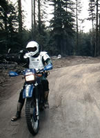 adventurers and their vehicles. The Rubicon Trail is normally run west to east (traveling east to west is referred to as “running backwards”). The western end of the Rubicon Trail has two trailheads. The true trailhead is located at the Wentworth Springs campground, while the more popular trailhead is at Loon Lake. These trails converge at Ellis Creek, approximately one mile from the start of each course.
The trail from the Wentworth Springs trailhead starts with an uphill climb. Once at the top, the trail levels out to a challenging drive to Ellis Creek. The trail from Loon Lake is more moderate. Beginning at the bottom of the spillway at the second dam, the trail passes through the Granite Bowl. It skirts Loon Lake on its way to Ellis Creek, where it joins with the Wentworth Springs section. From Ellis Creek, the trail winds through the trees on its way to Walker Hill.
Walker Hill is a challenging, uphill area that offers drivers a number of difficulties. This area contains three sections, each with its own challenge. First comes the lower, rock-strewn section, which makes a sharp turn to the right. Second is 100 feet (30 meters) of extreme trail that makes a turn to the left. Finally, you reach the third, upper section, referred to by some as the “sandstone section,” which is difficult terrain over decomposing rock. At the top of Walker Hill is a wide spot in the trail in a small grove of heavy timber. From here, the trail continues on toward the Little Sluice.
The Little Sluice is challenging and considered by many as the most difficult part of the Rubicon Trail. Though only about 100 feet (30 meters) long, it is heavily boulder-infested. Once through the Little Sluice, most drivers take a rest near Spider Lake (Spider Lake is closed to OHV access), a high mountain lake just above a low hill on the south side of the trail. From the Little Sluice and Spider Lake, the trail continues for approximately a mile to a granite shelf overlooking the Rubicon Valley and Buck Island Reservoir. At this point, the trail forks to the Granite Slab on the left and the Old Sluice on the right.
 The Granite Slab route is more scenic and less time-consuming. It makes its way to the right and down the granite face of the mountainside, rejoining the Old Sluice fork approximately half a mile before the Buck Island Reservoir.
The Old Sluice route is more difficult, following a section of the historic Rubicon Trail that is often bypassed due to its difficulty. The route is fairly level along the mountainside, first reaching the short Chappie Rock drop-off. From here, the trail continues on its level path until reaching another small overlook. From this overlook, the trail begins a gentle, then steep, descent into the Old Sluice.
The Granite Slab and Old Sluice routes rejoin just past the bottom of the Old Sluice. From here, the trail crosses over the dam at Buck Island Reservoir. The trail then skirts the eastern edge of the reservoir and bears left, up, and over a low mountain pass before heading down to the Big Sluice.
 The Big Sluice is another challenging section of the Rubicon Trail. Though misnamed (the Big Sluice traverses the side of the mountain rather than being walled on each side), this long downhill section offers rock after rock to crawl over.
After the Big Sluice, the trail crosses a bridge over the Rubicon River and heads down the Rubicon Valley. It passes through Rubicon Springs, continues on past the El Dorado County boundary line, and enters Placer County.
In 2009, El Dorado County with the assistance of California State Parks, Off-Highway Motor Vehicle Division Grant program implemented maintenance activities on the Rubicon Trail. The trail has also been surveyed and the trail location was adopted by the Board of Supervisors on January 26, 2010. El Dorado County, along with Rubicon Trail Foundation has developed trail markers, maps and educational materials to inform the public of the trail location. Law enforcement on the trail has increased in recent years to enforce all rules of the road.